
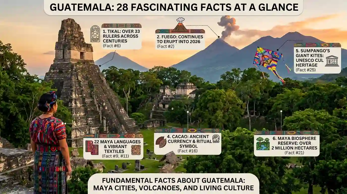
Guatemala is small in size but huge in stories. This Central American nation — nestled between Mexico to the north, Belize to the east, and Honduras to the southeast — packs ancient Maya cities, active volcanoes, and dense tropical forests into a compact territory. These 28 fun facts about Guatemala reveal a land where the past is never really past. Spanish shares the country with 22 Maya languages, Xinka, and Garifuna. Guatemala protects more than two million hectares in the Maya Biosphere Reserve, one of Central America’s largest protected areas. Meanwhile, Tikal preserves more than temples: its inscriptions record centuries of Maya political history across 33 rulers. As you explore these fun facts about Guatemala, you will see one theme again and again: Guatemala connects living culture with ancient landscapes. From giant kites flown in remembrance to Holy Week processions recognized by UNESCO, that connection makes the country far more interesting than a typical travel list suggests — with sources cited so you can verify the biggest claims.
Guatemala at a Glance
| Fact | Detail |
|---|---|
| Country | Guatemala |
| Region | Central America |
| Capital | Guatemala City |
| Population | 18,687,881 (2025) |
| Official monetary unit | Quetzal |
| Indigenous languages | 22 Maya languages, plus Xinka and Garifuna |
| UNESCO World Heritage properties | 4 |
| Maya Biosphere Reserve | 2,090,667 hectares |
| Holocene volcanoes | 20 listed by Smithsonian GVP |
| Highest point | Volcán Tajumulco, about 4,220 meters |
A Country Shaped by Mountains, Lakes, and Volcanoes
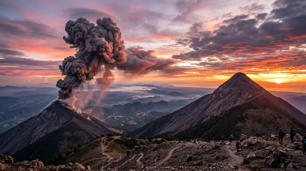
1. Guatemala has 20 Holocene volcanoes listed by Smithsonian scientists.
That does not mean all 20 are erupting today. The Holocene list covers volcanoes with activity during roughly the last 12,000 years. Guatemala sits along the Central America Volcanic Arc. This setting helps explain its dramatic mountains, volcanic soils, and many striking landscapes.
Smithsonian Global Volcanism Program — Guatemala volcanoes
2. Volcán de Fuego is among Guatemala’s most active volcanoes.
Fuego stands about 3,799 meters high. Its eruptive record stretches back centuries. The Smithsonian lists its latest known eruption as continuing in 2026. Activity can include explosions, ash plumes, lava, and pyroclastic flows. This makes Fuego both a geological landmark and a major natural hazard.
3. Pacaya has a complex volcanic history.
Pacaya is not simply one cone rising from flat land. It developed within the larger Amatitlán volcanic system. The Smithsonian describes the area as a complex basaltic volcano. Its modern activity has included Strombolian explosions and lava flows. Eruptions have sometimes affected roads, crops, and air travel.
4. Guatemala’s landscape rises from sea level to high mountains.
The country’s elevation changes create many different environments. Coastal wetlands, tropical forests, highland valleys, and mountain ecosystems can occur within one country. Volcanic terrain adds another layer. This sharp elevation range helps explain Guatemala’s unusual mix of climates, plants, and wildlife.
Tikal Shows How Large the Maya World Was
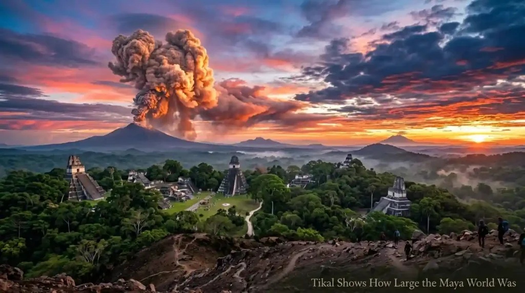
5. Tikal was much more than a group of pyramids.
UNESCO describes Tikal as a major political, economic, and military center. Its inner urban zone covers about 400 hectares. The wider archaeological area includes reservoirs, roads, residences, and other structures. The site therefore reveals how a large Maya city functioned, not simply how its temples looked.
6. Tikal’s written records preserve a long royal history.
Tikal’s monuments record rulers across many centuries. UNESCO identifies 33 rulers in its dynastic sequence. The surviving inscriptions cover the period from 292 BC to AD 869. That makes the site valuable for studying Maya politics, leadership, warfare, and cultural change.
7. Tikal is also a major wildlife refuge.
The national park covers 57,600 hectares. UNESCO records more than 200 tree species and over 2,000 higher plants. The area also supports jaguars, pumas, monkeys, anteaters, and more than 300 bird species. Archaeology and tropical ecology therefore exist side by side at Tikal.
8. Tikal is both cultural and natural World Heritage.
Tikal entered the UNESCO World Heritage List in 1979. It is unusual because its importance is both cultural and natural. The site contains major Maya monuments and rich tropical ecosystems. This combination makes Tikal more than an archaeological destination. It is also part of the wider Maya Forest.
Guatemala’s Living Languages Tell Another Story
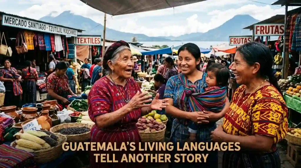
9. Guatemala recognizes 22 languages of Maya origin.
Spanish is the country’s official language. Yet Guatemala’s linguistic landscape is much broader. National statistics identify 22 Maya languages, alongside Xinka and Garifuna. Languages such as K’iche’, Kaqchikel, Mam, and Q’eqchi’ have large communities. This diversity reflects living cultures, not only ancient history.
10. Indigenous identity in Guatemala is strongly linked with language.
Language can carry history, community ties, and cultural knowledge. Guatemala’s census records language use among people aged seven and older. It shows that many people speak more than one language. Spanish often functions alongside an Indigenous language in daily life.
11. Traditional clothing can communicate community identity.
Maya textiles often use distinctive colors, patterns, and designs. The Metropolitan Museum notes that clothing patterns in the Guatemalan Highlands can indicate cultural and linguistic affiliation. In some communities, clothing can therefore tell observers where someone comes from. A textile can work almost like a visual language.
12. Rabinal Achí preserves a rare pre-Hispanic tradition.
Rabinal Achí is a Maya dance drama that developed in the fifteenth century. It combines masked dance, theatre, and music. UNESCO added it to the Representative List of Intangible Cultural Heritage in 2008. The tradition connects performance with Maya history, politics, mythology, and community memory.
UNESCO — Guatemala’s Intangible Cultural Heritage
Jade, Cacao, and Trade Connected Ancient Guatemala
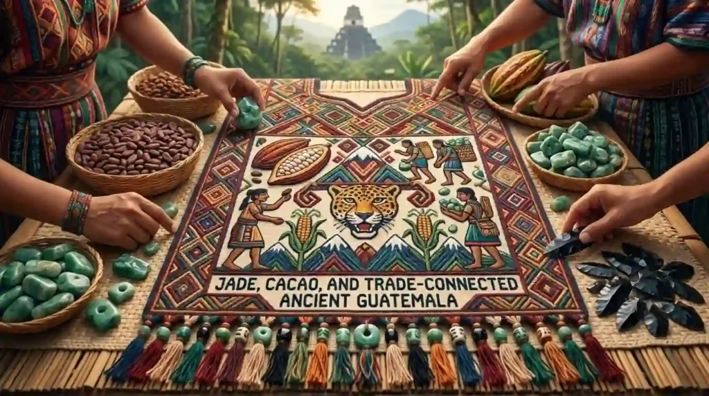
13. Guatemala’s Motagua Valley is famous for Maya jade.
The Motagua River Valley in northeastern Guatemala was a major source of jade. The Metropolitan Museum notes that jade was valuable because obtaining and shaping it required considerable labor. Maya rulers used jade in elite ornaments. The stone therefore linked Guatemala’s geology with ancient power, status, and craftsmanship.
14. Ancient Maya traders moved more than finished objects.
Archaeological evidence shows long-distance exchange across Mesoamerica. Tak’alik Ab’aj in Guatemala sat along an important ancient trade route. UNESCO describes materials and ideas moving across large distances — networks that also reached into present-day Mexico. This exchange influenced architecture, sculpture, writing, mathematics, calendars, and water management.
15. Cacao had important cultural value in ancient Mesoamerica.
Cacao was not simply a sweet treat. Historical and archaeological evidence connects it with Maya ritual life, social status, food, and exchange. Cacao drinks could be linked with ceremonies and important gatherings. Ancient preparations were also very different from modern sweet chocolate.
16. Cacao beans could function as a form of money.
Historical evidence shows cacao beans were valuable enough to serve as currency in parts of Mesoamerica. Guatemala’s own central bank notes that Maya communities used cacao among other valuable goods. This gives chocolate history an unexpected economic side. A cacao bean could once represent purchasing power.
Banco de Guatemala — History of the Quetzal and Maya currency
Antigua Guatemala Was Rebuilt After Disaster
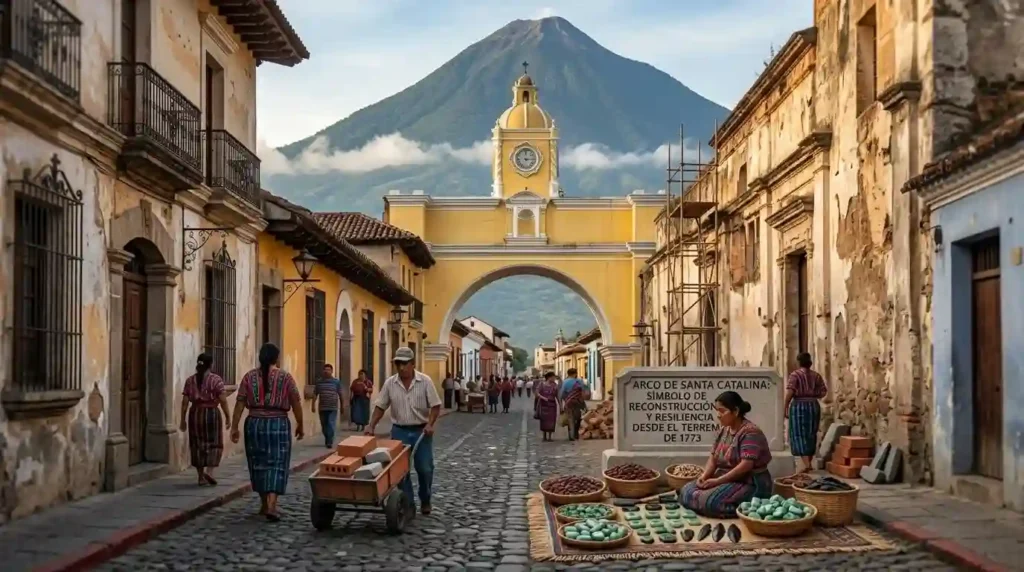
17. Antigua Guatemala was founded in the sixteenth century.
The city began as Santiago de Guatemala. UNESCO says its third location was established in the Panchoy Valley in 1543. It later became the capital of the Captaincy-General of Guatemala. Its streets and monuments still reflect the planning and architecture of the colonial period.
18. Antigua sits about 1,530 meters above sea level.
That elevation gives Antigua a very different setting from Guatemala’s tropical lowlands. UNESCO describes the city as being in an earthquake-prone region. Its location helped shape both its history and architecture. Earthquakes repeatedly damaged buildings, leaving many monuments preserved today as ruins.
19. The earthquake of 1773 changed Guatemala’s history.
A major earthquake devastated Antigua in 1773. The destruction helped end the city’s long role as the regional capital. Guatemala’s capital was later moved to a new location. Today, the ruins remain a major part of Antigua’s identity and heritage.
20. Antigua’s ruins are part of its appeal.
Many historic buildings were never completely restored. Instead, their damaged walls and surviving structures remain visible. UNESCO recognizes the city’s preserved monuments and ruins as part of its Outstanding Universal Value. The result is unusual: destruction itself became part of the city’s architectural story.
UNESCO — Antigua Guatemala
The Maya Forest Is Bigger Than Tikal
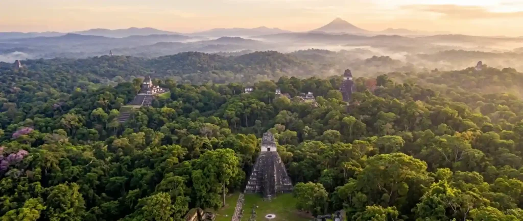
21. The Maya Biosphere Reserve covers over two million hectares.
Guatemala’s Maya Biosphere Reserve covers 2,090,667 hectares. CONAP describes it as the country’s largest protected area. It occupies roughly one-fifth of Guatemala’s territory. The reserve protects forests, wetlands, wildlife habitats, and important archaeological sites across the Petén region.
22. The reserve protects both nature and Maya heritage.
The Maya Biosphere Reserve is not only a wildlife sanctuary. It also contains major archaeological sites. Forests surround ancient Maya settlements and monuments. This creates a rare overlap between conservation and archaeology. Protecting the forest can also help protect the landscape surrounding ancient cultural sites.
23. Community forestry plays a role in conservation.
Guatemala has developed forest concessions within parts of the reserve. CONAP reports that community groups manage some of these areas. The model combines natural-resource use with conservation goals. It shows that protected landscapes do not always depend on excluding local communities from economic activity.
24. Tikal sits inside the wider Maya Forest.
Tikal’s importance becomes clearer when viewed from above. The ruins occupy only part of a much larger forest landscape. UNESCO describes the park as embedded within the Maya Biosphere Reserve. Forests, wetlands, wildlife, reservoirs, and ancient architecture form one connected cultural landscape.
Guatemala’s History Still Lives in Public Traditions
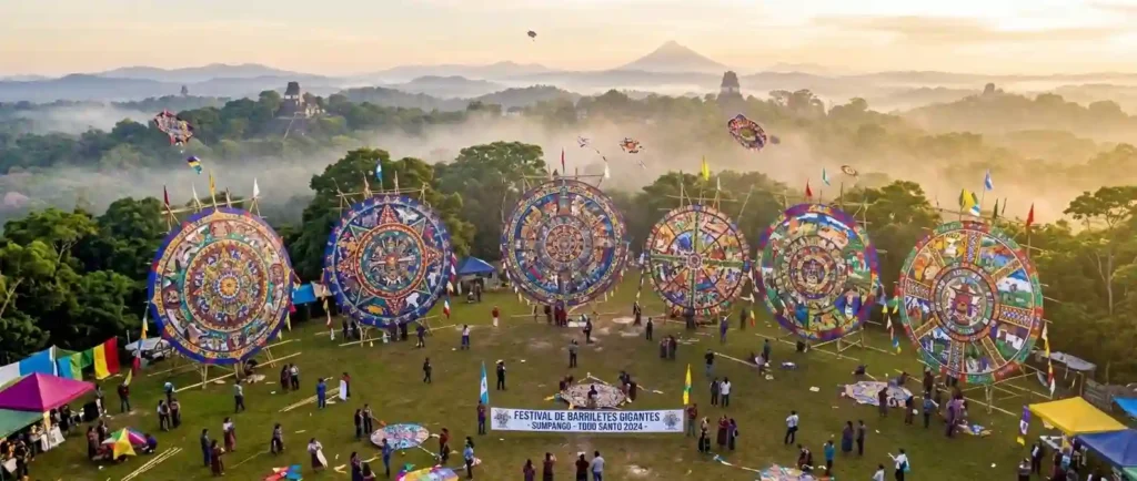
25. Giant kites are part of Guatemala’s recognized heritage.
UNESCO added the technique of making giant kites in Santiago Sacatepéquez and Sumpango to its Representative List in 2024. These kites are linked with communal celebrations and remembrance. Their large scale and intricate designs make them striking examples of living Guatemalan cultural expression.
26. Holy Week in Guatemala is UNESCO-recognized heritage.
Guatemala’s Holy Week traditions were added to UNESCO’s Representative List in 2022. The celebrations include processions, religious practices, music, art, and community participation. This recognition shows that Guatemala’s heritage is not limited to archaeological ruins. Many traditions remain active in modern communities.
27. Guatemala has four UNESCO World Heritage properties.
UNESCO currently lists four properties for Guatemala. They include Antigua Guatemala, Tikal National Park, Quirigua, and Tak’alik Ab’aj. Three are cultural properties, while Tikal is also recognized for natural value. Together, they show the country’s unusual blend of archaeology, architecture, and biodiversity.
28. Guatemala’s heritage crosses many time periods.
Tak’alik Ab’aj alone spans about 1,700 years of history. UNESCO dates its archaeological sequence from around 800 BC to AD 900. The site also shows a transition from Olmec cultural traditions toward early Maya culture. Guatemala’s history therefore cannot be reduced to one civilization or period.
UNESCO — Guatemala World Heritage properties
Myths vs. Reality
Myth: Guatemala is mainly famous because of Tikal.
Reality: Tikal is important, but Guatemala has three other UNESCO World Heritage properties. Its heritage also includes living traditions, languages, textiles, forests, and colonial architecture.
Myth: Guatemala has only one Indigenous language.
Reality: Guatemala has 22 Maya languages, plus Xinka and Garifuna. Spanish is official, but the country’s linguistic identity is much broader.
Myth: Every Guatemalan volcano is active.
Reality: Smithsonian’s list contains 20 Holocene volcanoes. That does not mean all are erupting or active today.
Experience Guatemala: 5 Unforgettable Moments
Guatemala rewards travelers who go beyond the ruins. These five experiences capture the country’s living culture, dramatic landscapes, and deep history. For more Central American adventures, see our fun facts about El Salvador and fun facts about Costa Rica.
Watch the sunrise over Tikal. Arrive before dawn at the Gran Plaza as howler monkeys call and the temple tops emerge from the jungle mist — the classic Tikal experience.
Walk Antigua during Holy Week. Guatemala’s UNESCO-recognized Holy Week brings elaborate processions and intricate sawdust carpets to Antigua’s colonial streets.
Sail Lake Atitlán. Ringed by volcanoes and Maya villages, Lake Atitlán is regularly ranked among the most beautiful lakes in the world.
Bargain at Chichicastenango’s market. The highland town’s Thursday and Sunday markets overflow with textiles, masks, and flowers — and the colors can signal a vendor’s home community.
Hike Pacaya’s lava fields. Guided treks up this active volcano cross recent lava flows, with views of neighboring Fuego and Acatenango on clear days.
FAQ: Fun Facts About Guatemala
What is Guatemala best known for?
Guatemala is widely known for Maya archaeological sites, volcanoes, highland landscapes, textiles, and living Indigenous cultures. Tikal is especially important because it combines major Maya ruins with rich tropical biodiversity.
Why does Guatemala have so many volcanoes?
Guatemala lies along the Central America Volcanic Arc. Tectonic processes beneath the region produce magma and volcanic activity. This geological setting created many of the country’s volcanic mountains.
What is Guatemala’s national currency?
Guatemala’s monetary unit is the quetzal. The currency was created by monetary reform in 1924. The name comes from the country’s famous quetzal bird.
When did Guatemala become independent?
Guatemala marked independence from Spanish colonial rule on September 15, 1821. The event was part of the independence of Central America.
What is Guatemala’s capital called?
The capital is Guatemala City. Its official historical name is Nueva Guatemala de la Asunción. The modern capital was established in the Valley of the Hermitage in 1776.
What makes Guatemalan textiles special?
Traditional textiles can express community identity through colors, patterns, and designs. In some highland communities, clothing can provide clues about cultural and linguistic affiliation.
Is Guatemala’s quetzal bird connected to its currency?
Yes. The quetzal is Guatemala’s national bird and also gives its name to the national currency. The bird has long held cultural importance in Guatemala.
Conclusion
The most fascinating thing about Guatemala is its connection between past and present. Ancient cities still rise from living forests. Maya languages remain part of daily life. Volcanoes continue shaping the land. Traditional arts still carry community memory. Even Guatemala’s currency carries an older cultural symbol. When I think about fun facts about Guatemala, I do not see isolated trivia. I see a country where geography, history, language, and culture keep meeting. That is what makes Guatemala memorable. Its greatest stories are not locked inside museums. Many are still alive in forests, towns, languages, traditions, and everyday life.

Irshad Ullah is a content writer at Fun Facts Horizon. He researches and writes verified fun facts about countries, animals, space, history, and more for curious readers.
2 thoughts on “Fun Facts About Guatemala: 28 Amazing Discoveries”