
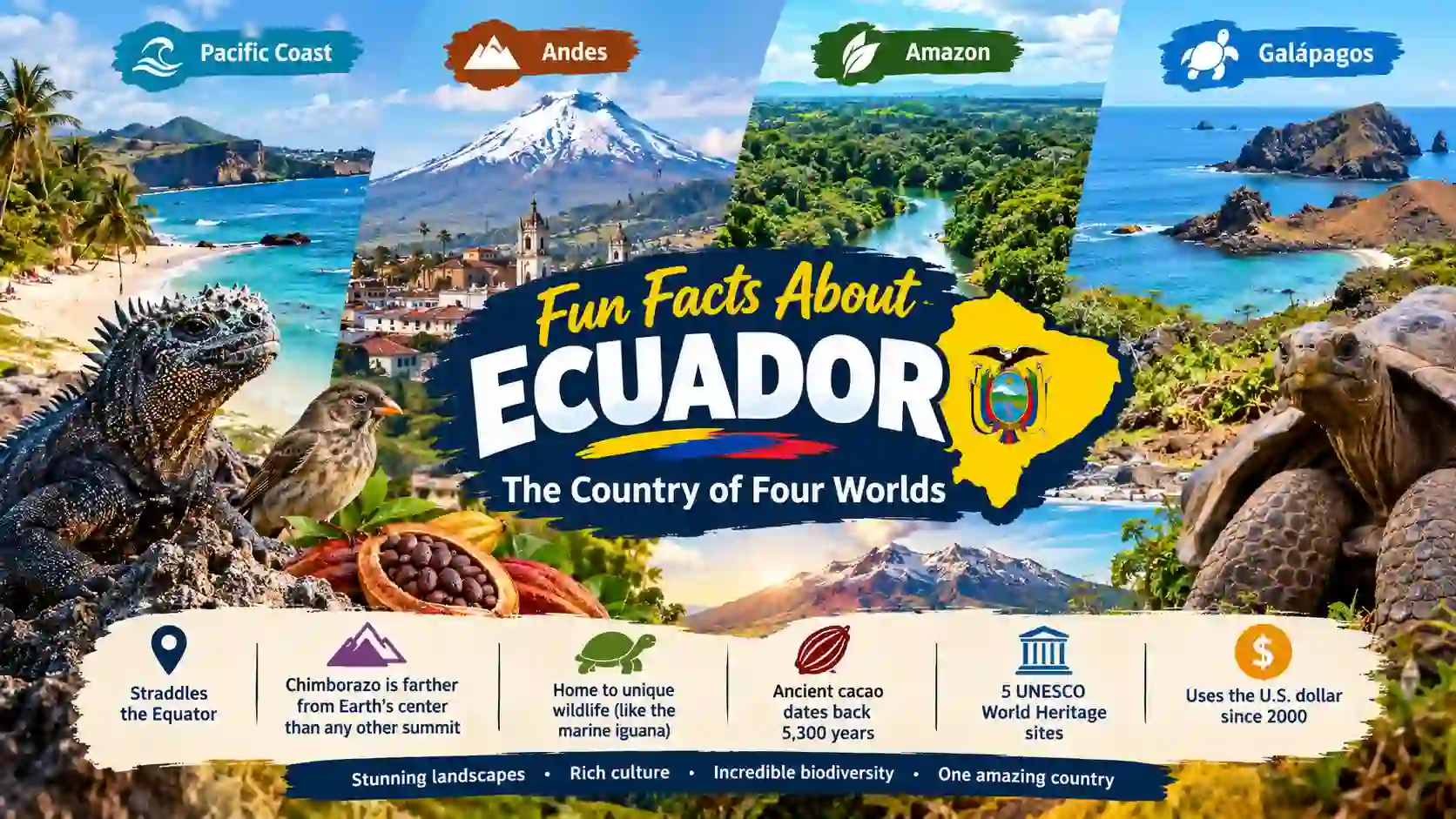
Ecuador may look small on a world map. Yet its landscapes change quickly. You can move from Pacific beaches to snowy volcanoes. You can also reach Amazon rainforest and remote islands. Ecuador sits on the Equator, but that is only the beginning. Its Galápagos Islands helped shape modern ideas about evolution. Its Chimborazo volcano reaches farther from Earth’s center than any other mountain summit. Even chocolate has an ancient Ecuadorian story. Archaeologists found cacao evidence dating back about 5,300 years. I find Ecuador fascinating because its geography feels like several countries joined together. These fun facts about Ecuador reveal how nature, history, science, and culture meet in one remarkable place.
Ecuador at a Glance
| Feature | Quick Fact |
| Capital | Quito |
| Location | Northwestern South America |
| Famous islands | Galápagos Islands |
| Major mountain | Chimborazo |
| Famous volcano | Cotopaxi |
| Main language | Spanish |
| Legal currency | U.S. dollar |
| UNESCO World Heritage properties | 5 |
| Main geographic worlds | Coast, Andes, Amazon, Galápagos |
| Famous ancient crop | Cacao |
1. Ecuador Has Four Very Different Worlds
1. Ecuador brings four major regions together.
Ecuador is often described through four natural worlds. They are the Pacific Coast, Andes, Amazon, and Galápagos. Each region has different landscapes and wildlife. The Coast brings beaches and warm Pacific waters. The Andes bring high mountains and volcanoes. The Amazon brings rainforest. The Galápagos brings isolated volcanic islands.
2. The country changes dramatically across short distances.
Ecuador’s geography creates sharp changes in climate. High Andean areas can feel cold and dry. Coastal areas can feel warm and humid. Amazon areas are much wetter. The Galápagos has its own ocean-driven climate patterns. This variety helps explain Ecuador’s remarkable biological diversity.
3. The Equator crosses Ecuador.
The country’s name comes from its position near the Equator. The Equator passes through Ecuadorian territory. Quito lies just south of the Equator. Visitors can also visit sites built around the famous latitude line. The location gives Ecuador a strong connection with Earth’s geography.
4. Ecuador is relatively compact.
Ecuador covers about 256,370 square kilometres. That makes its geographic variety especially striking. Large mountain systems, forests, beaches, and islands fit within one national territory. Travel between regions can reveal major environmental changes. Few countries offer such different landscapes within a compact area.
Source: [Ecuador Travel — Four Regions]
2. The Galápagos Changed How We Understand Nature
5. The Galápagos lies about 1,000 kilometres offshore.
The Galápagos Islands sit in the Pacific Ocean. They are about 1,000 kilometres from mainland Ecuador. Their isolation helped unusual species evolve. Ocean currents also bring different marine environments together. This combination makes the islands important for studying evolution and island ecology.
6. Galápagos has 19 major islands.
UNESCO identifies 19 large islands in the archipelago. The wider archipelago also includes many smaller islands, islets, and rocks. Only a small number of the larger islands have permanent settlements. Much of the island territory remains protected.
7. The marine iguana is found only there.
The Galápagos marine iguana is a remarkable island species. It is the world’s only marine iguana. These reptiles adapted to life around the sea. They feed mainly on marine algae. Their unusual appearance shows how isolation can shape animal evolution.
8. Charles Darwin visited the islands in 1835.
Charles Darwin reached the Galápagos during the voyage of HMS Beagle. The islands later became closely linked with his work on evolution. Their isolated animals offered important examples of variation. Galápagos wildlife still helps scientists study evolutionary processes.
9. Galápagos became a World Heritage site in 1978.
UNESCO added the Galápagos Islands to its World Heritage List in 1978. The site was later expanded to include the Galápagos Marine Reserve. UNESCO describes the islands as a living museum and showcase of evolution. Their natural value reaches beyond the land itself.
Source: [UNESCO World Heritage Centre — Galápagos Islands]
3. Ecuador’s Mountains Have Some Extreme Records
10. Chimborazo reaches farther from Earth’s center.
Chimborazo is not Earth’s highest mountain above sea level. Yet its summit is farther from Earth’s center than any other mountain summit. Earth bulges slightly around the Equator. Chimborazo lies close to that bulge. This gives the mountain a remarkable geographic advantage.
11. Chimborazo is an inactive volcano.
Chimborazo is a massive volcanic mountain in Ecuador’s Andes. NASA describes it as a dormant volcano. Its summit attracts climbers from around the world. The mountain also provides scientists with a striking example of how Earth’s shape affects measurements.
12. Cotopaxi rises to 5,911 metres.
Cotopaxi is one of Ecuador’s most famous volcanoes. The Smithsonian Global Volcanism Program lists its elevation as 5,911 metres. It has a steep, symmetrical cone and a glacier-covered summit. Its appearance has made it one of the country’s best-known natural landmarks.
13. Cotopaxi is one of Ecuador’s most active volcanoes.
Cotopaxi has erupted many times during historical times. The Smithsonian Global Volcanism Program records more than 50 eruptions since the sixteenth century. Its eruptions can produce ash, pyroclastic flows, and lahars. These volcanic mudflows can travel far beyond the summit.
14. Sangay contains several major ecosystems.
Sangay National Park stretches from rainforest to high volcanic landscapes. UNESCO records ecosystems ranging from about 900 metres to more than 5,300 metres. The park includes forests, páramo, wetlands, glaciers, and volcanic areas. This makes it a powerful example of Ecuador’s vertical biodiversity.
Source: [NASA Science and Smithsonian Global Volcanism Program]
4. Ecuador’s Biodiversity Goes Far Beyond the Galápagos
15. Yasuní is exceptionally rich in species.
Yasuní lies in Ecuador’s Amazon region. UNESCO describes its Biosphere Reserve as one of the most biodiverse areas per square metre on Earth. Its forests support many plant and animal species. The region also has deep cultural importance for Indigenous communities.
16. Yasuní covers more than 2.7 million hectares.
UNESCO lists the Yasuní Biosphere Reserve at about 2,756,427 hectares. That is an enormous protected landscape. It contains humid tropical rainforest within the upper Amazon Basin. Its size helps protect connected habitats rather than isolated patches.
17. Sangay protects mountain and rainforest species.
Sangay National Park supports species such as mountain tapirs and spectacled bears. Its isolation has helped protect native wildlife. The park also supports Andean condors and many other species. Its elevation changes create many habitats within one protected landscape.
18. Ecuador has seven UNESCO Biosphere Reserves.
As of 2026, UNESCO identifies seven Biosphere Reserves in Ecuador. These include places representing Amazonian, Andean, coastal, and island environments. Biosphere reserves support conservation, research, and sustainable human activity. They show how Ecuador protects different types of landscapes.
Source: [UNESCO — Yasuní Biosphere Reserve]
5. Ecuador Has World Heritage Stories Beyond the Islands
19. Quito was inscribed by UNESCO in 1978.
Quito’s historic centre became a UNESCO World Heritage property in 1978. Its churches, plazas, streets, and historic buildings reflect centuries of cultural development. UNESCO recognizes the city’s architectural and urban importance. Its high Andean setting adds another distinctive feature.
20. Quito and Galápagos were both listed in 1978.
Ecuador had two properties among UNESCO’s first World Heritage inscriptions. Quito and the Galápagos Islands were both inscribed in 1978. This created an unusual pairing. One property represented cultural heritage. The other represented exceptional natural heritage.
21. Ecuador now has five World Heritage properties.
UNESCO currently lists five World Heritage properties for Ecuador. They include Quito, Cuenca, Galápagos, Sangay National Park, and the Qhapaq Ñan Andean Road System. These sites represent cultural landscapes, historic cities, ecosystems, and ancient transport networks.
22. Cuenca joined the list in 1999.
The Historic Centre of Santa Ana de los Ríos de Cuenca became a World Heritage property in 1999. UNESCO highlights its planned colonial urban form. The city also shows how different cultures shaped Latin American cities. Its Andean location adds to its character.
Source: [UNESCO World Heritage Centre — Ecuador]
6. Ecuador Has a 5,300-Year-Old Cacao Story
23. Ancient Ecuadorians used cacao thousands of years ago.
Archaeologists found cacao evidence at Santa Ana-La Florida. The site lies in southeastern Ecuador. Scientific testing found cacao starch, theobromine residues, and ancient DNA. The evidence dates to roughly 5,300 years ago. This makes Ecuador central to the early history of cacao.
24. The discovery changed the cacao story.
For many years, cacao’s early history focused strongly on Mesoamerica. Research at Santa Ana-La Florida changed that picture. Evidence now points to the upper Amazon as an early centre of cacao domestication. Ecuador therefore has a major place in chocolate’s deeper history.
25. Cacao evidence came from ancient containers.
Researchers found traces of cacao in archaeological vessels. They used several scientific methods to confirm the plant’s presence. These included starch analysis, chemical evidence, and ancient DNA. Using different methods made the archaeological conclusion much stronger.
26. The famous Panama hat is actually Ecuadorian.
The traditional Panama hat is strongly associated with Ecuador. Ecuadorian artisans have produced woven straw hats for centuries. The name became linked with Panama because the hats were widely used there. The famous label therefore hides their Ecuadorian origin.
Source: [Nature Ecology & Evolution — Ancient Cacao Research]
7. Ecuador Has Some Unexpected Cultural Facts
27. Ecuador adopted the U.S. dollar in 2000.
Ecuador adopted the U.S. dollar as legal tender on January 9, 2000. The dollar replaced the Ecuadorian sucre. Ecuador’s Central Bank still issues some national fractional coins. The change remains one of the country’s most distinctive modern economic features.
28. Ecuador’s old currency was the sucre.
The sucre served as Ecuador’s currency before dollarization. The Central Bank records that the sucre circulated for 116 years. It was used from 1884 until the transition to the dollar in 2000. The currency remains an important part of Ecuador’s economic history.
29. Ecuador’s heritage connects many regions.
Ecuador’s cultural identity is not limited to Quito or the Galápagos. Historic cities, Andean communities, Amazonian cultures, coastal traditions, and island communities all contribute to the country’s identity. Its geography helped create many distinct regional traditions.
30. Ecuador’s greatest surprise may be its variety.
A single country can offer glaciers, volcanoes, rainforest, beaches, and volcanic islands. It can also connect ancient cacao history with modern conservation. That combination makes Ecuador more than a destination with famous islands. Its real story is the meeting of many worlds.
Source: [Banco Central del Ecuador — Dollarization History]
Myths vs. Reality
| Myth | Reality |
| Ecuador is named after a mountain. | Its name relates to the Equator. |
| The Panama hat comes from Panama. | The traditional hat originated in Ecuador. |
| Chimborazo is Earth’s tallest mountain. | Everest is higher above sea level. Chimborazo is farther from Earth’s center. |
| The Galápagos is just one island. | The archipelago contains many islands, islets, and rocks. |
| Ecuador’s biodiversity exists only in Galápagos. | The Andes, Amazon, Coast, and Galápagos all support rich biodiversity. |
FAQ: Fun Facts About Ecuador
What is Ecuador best known for?
Ecuador is especially known for the Galápagos Islands, Andes, Amazon rainforest, and Equator. It is also famous for volcanoes, biodiversity, cacao, and historic Quito.
Why is Ecuador called Ecuador?
The name comes from Ecuador’s location around the Equator. The Equator crosses the country’s territory in northwestern South America.
What is the most interesting fact about Ecuador?
One striking fact is about Chimborazo. Its summit is farther from Earth’s center than any other mountain summit because Earth bulges around the Equator.
What are 3 interesting facts about Ecuador?
Ecuador has four major geographic regions. Its Galápagos Islands inspired evolutionary research. Ancient cacao evidence from Ecuador dates back about 5,300 years.
Is the Panama hat really from Ecuador?
Yes. Traditional Panama hats are Ecuadorian products. Their name became associated with Panama because of their historical use there.
What makes Ecuador so biodiverse?
Ecuador has major differences in elevation and climate. It contains Pacific coastlines, Andes mountains, Amazon rainforest, and isolated Galápagos islands.
Does Ecuador use the U.S. dollar?
Yes. Ecuador adopted the U.S. dollar as legal tender on January 9, 2000.
How old is cacao in Ecuador?
Archaeological evidence from Santa Ana-La Florida dates cacao use to roughly 5,300 years ago. Researchers used multiple scientific methods to identify the evidence.
Conclusion
Ecuador is a country where geography tells the story. The Equator crosses its land, but the country’s identity reaches far beyond that line. Volcanoes rise above Andean valleys. Rainforests stretch across the Amazon. Pacific waters surround the Galápagos. Ancient cacao connects Ecuador to deep human history. These fun facts about Ecuador show why this country deserves closer attention. What I find most memorable is the contrast. A relatively compact country can hold so many worlds. Ecuador proves that size does not decide how much nature, culture, and history a place can contain.

hello! I am Irshad Ullah, and a passionate writer and lifelong learner dedicated to uncovering fascinating facts about science, history, nature, animals, space, and the world around us. I research each topic carefully and transform surprising information into clear, engaging, and enjoyable content. My goal is to satisfy curiosity, inspire learning, and help readers discover something amazing every day.