
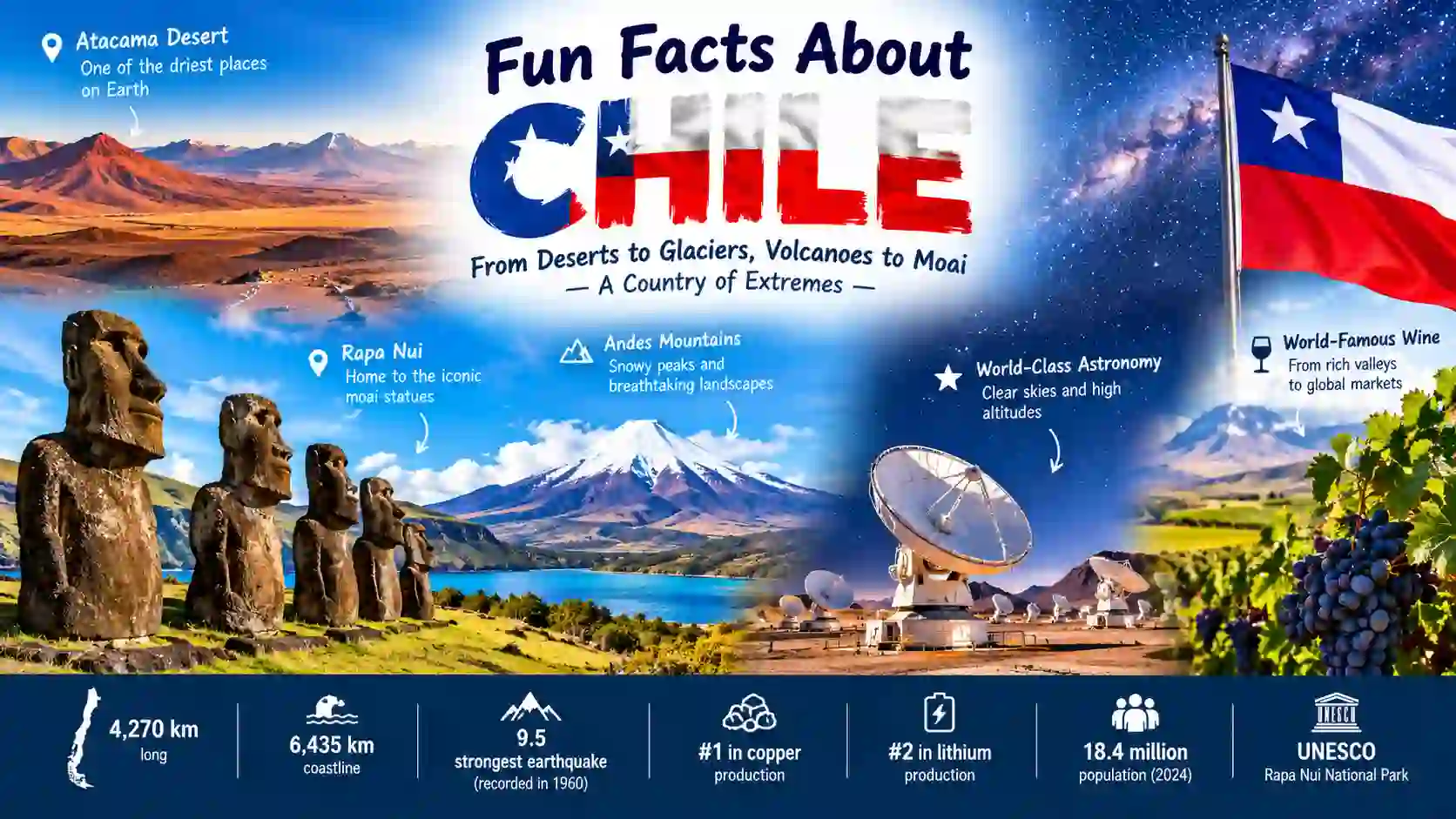
Chile is a country of extremes. It stretches for thousands of kilometers along South America’s Pacific coast. Its land includes dry deserts, snowy mountains, glaciers, islands, and forests. Chile is also home to one of Earth’s driest deserts and some of the world’s best astronomy sites. Its history includes the ancient culture of Rapa Nui and the world’s strongest recorded earthquake. Chile also plays a major role in copper and lithium production. These fun facts about Chile reveal why this long, narrow country is so unusual. From the Atacama Desert to Easter Island, Chile offers a remarkable mix of nature, science, culture, and geography.
Chile Has One of the World’s Most Unusual Shapes
- Chile is extremely long and narrow.
Chile stretches about 4,270 kilometers from north to south. Its average width is only about 180 kilometers. This gives Chile one of the most distinctive shapes among countries. Source: Government of Chile. Government of Chile — Our Country - Chile has more than 6,400 kilometers of coastline.
The country faces the Pacific Ocean along much of its western edge. Its official government information gives the coastline as about 6,435 kilometers. Source: Government of Chile. - Chile is divided into three geographical areas.
These are continental Chile, insular Chile, and the Chilean Antarctic Territory. The Antarctic claim is subject to the Antarctic Treaty system. Source: Government of Chile. - Chile borders three countries on mainland South America.
Chile shares land borders with Peru, Bolivia, and Argentina. The Andes form much of its eastern boundary with Argentina and Bolivia. Source: Government of Chile. - Chile claims a presence across three continents.
Chile describes itself as tricontinental because its territory includes South America, Pacific islands associated with Oceania, and its Antarctic claim. Source: Government of Chile.
The Atacama Desert Is a Natural Laboratory
- The Atacama is one of Earth’s driest places.
Some parts of the Atacama receive almost no measurable rainfall for long periods. NASA describes it as an extreme dry environment and a useful comparison for Mars. Source: NASA. - The desert helps scientists study Mars.
NASA researchers have tested life-detection technology in the Atacama. Its dry, rocky soils can resemble some harsh conditions found on Mars. Source: NASA. - Some Atacama areas can go years without rain.
The desert does not have the same dryness everywhere. Rainfall changes across the region, with some areas receiving only tiny amounts over long periods. Source: NASA. - The Atacama can suddenly become colorful.
Rare rainfall can trigger plant growth across normally dry landscapes. NASA documented a major burst of vegetation after unusual rainfall in northern Chile in 2019. Source: NASA. - The Salar de Atacama contains lithium-rich brines.
This huge salt flat contains underground brines rich in lithium salts. Lithium is important for modern batteries and other technologies. Source: NASA. NASA — Salar de Atacama
Chile Is a Giant Observatory Under the Stars
- Chile hosts the ALMA radio telescope array.
ALMA is made of 66 high-precision antennas. They work together to study very cold objects and regions of the Universe. Source: European Southern Observatory. - ALMA sits about 5,000 meters above sea level.
Its Chajnantor site is extremely high and dry. These conditions reduce atmospheric water vapor that can interfere with millimeter and submillimeter observations. Source: European Southern Observatory. - ALMA’s antennas can spread across 16 kilometers.
The antennas can be arranged over distances reaching about 16 kilometers. This arrangement helps astronomers create detailed observations of distant objects. Source: European Southern Observatory. - Chile’s Paranal Observatory has remarkably clear skies.
Long-term measurements from 2014–2024 show clear or photometric conditions during about 77% of nighttime at Paranal. Source: European Southern Observatory. - The Milky Way can cast a visible shadow at Chilean observatories.
ESO reports that on a clear, moonless night, the Milky Way can be bright enough to create a visible shadow. Source: European Southern Observatory. ESO — Paranal Observatory Sky Conditions
Chile Sits in a Powerful Earthquake Zone
- Chile experienced the strongest recorded earthquake.
On May 22, 1960, an earthquake struck southern Chile with a magnitude of 9.5. USGS lists it as the largest earthquake recorded by modern instruments. Source: U.S. Geological Survey. - The 1960 earthquake generated a huge tsunami.
The earthquake caused tsunami waves that affected areas far beyond Chile. The event reached across the Pacific, including Hawaii and Japan. Source: U.S. Geological Survey. - Chile also experienced a magnitude 8.8 earthquake in 2010.
The February 27, 2010 earthquake struck offshore near central Chile. USGS lists it among the largest earthquakes recorded since 1900. Source: U.S. Geological Survey. - Chile has many volcanoes.
The Smithsonian Global Volcanism Program lists 90 Holocene volcanoes for Chile. The list includes volcanoes within national territory and relevant maritime zones. Source: Smithsonian Global Volcanism Program.
Smithsonian Global Volcanism Program — Chile Volcanoes
Rapa Nui Connects Chile With Ancient Polynesian Culture
- Easter Island is also called Rapa Nui.
Rapa Nui is the Indigenous name for the island commonly known as Easter Island. It is part of Chile and lies far out in the Pacific Ocean. Source: UNESCO. - Rapa Nui is about 3,700 kilometers from continental Chile.
UNESCO describes Easter Island as one of the most remote inhabited islands on Earth. Its isolation helped shape its distinctive cultural history. Source: UNESCO. - The famous moai were built between the 10th and 16th centuries.
These enormous stone figures were created by the Polynesian society of Rapa Nui. They form one of the world’s best-known archaeological landscapes. Source: UNESCO. - Rapa Nui was settled by Polynesians.
UNESCO states that a Polynesian society settled the island around AD 300. The culture later developed its own remarkable traditions of sculpture and architecture. Source: UNESCO. - Rapa Nui National Park is a UNESCO World Heritage site.
The site was added to the World Heritage List in 1995. It protects important archaeological remains, including moai, ceremonial structures, houses, and petroglyphs. Source: UNESCO. UNESCO — Rapa Nui National Park
Chile Is Rich in Minerals and Agriculture
- Chile was the world’s leading mined-copper producer in 2024.
USGS reported that Chile accounted for about 24% of world mined copper production that year. Copper is a major part of the country’s mineral economy. Source: U.S. Geological Survey. - Chile is also a major lithium producer.
USGS estimated that Chile ranked second in lithium production in 2024, excluding U.S. production. It accounted for about 22% of world production under that measure. Source: U.S. Geological Survey. - Chile produces large amounts of iodine.
USGS estimated that Chile accounted for about 66% of world iodine production in 2024, excluding U.S. production. Source: U.S. Geological Survey. - Chile has a major wine industry.
Chile’s agriculture authority describes its wine industry as highly developed and strongly connected to international markets. Vineyards are spread across several regions of the country. Source: Chilean Office of Agricultural Studies and Policies. ODEPA — Wine and Pisco in Chile
Chile Protects Vast Landscapes of Ice and Wildlife
- Bernardo O’Higgins National Park is enormous.
CONAF lists its area at more than 3.5 million hectares. It protects mountains, glaciers, fjords, forests, and large ice fields in southern Chile. Source: CONAF. - The park protects parts of the Southern Patagonian Ice Field.
CONAF states that the park contains major ice areas, including parts of the Southern Patagonian Ice Field and other Patagonian ice fields. Source: CONAF. - The huemul appears on Chile’s national coat of arms.
The huemul is a deer found in the southern Andes. Along with the Andean condor, it forms part of Chile’s national coat of arms. Source: Chilean Ministry of Foreign Affairs. - Chile’s national coat of arms dates to the 19th century.
The current design was accepted in 1834. It features a huemul and a condor as its supporting animals. Source: Chilean Ministry of Foreign Affairs. Chile Ministry of Foreign Affairs — National Emblems
Chile by the Numbers
| Feature | Chile |
| Continental length | About 4,270 km |
| Average width | About 180 km |
| Coastline | About 6,435 km |
| 2024 census population | 18,480,432 |
| ALMA antennas | 66 |
| ALMA elevation | About 5,000 m |
| 1960 earthquake | Magnitude 9.5 |
| 2024 mined copper share | About 24% of world production |
| Rapa Nui distance from mainland | About 3,700 km |
Sources: Government of Chile; Chilean National Statistics Institute; ESO; USGS; UNESCO.
FAQ: Fun Facts About Chile
1. What is Chile famous for?
Chile is famous for the Atacama Desert, Andes Mountains, Rapa Nui and its moai, astronomy, copper production, glaciers, wine, and dramatic Pacific coastline.
2. Why is Chile so long and narrow?
Chile occupies a narrow strip between the Pacific Ocean and the Andes. Its geography creates its unusual north-to-south shape.
3. Is the Atacama Desert the driest place on Earth?
Parts of the Atacama are among the driest places on Earth. Some locations have extremely little rainfall for long periods.
4. Why are there so many observatories in Chile?
Northern Chile has high mountains, very dry air, and unusually clear skies. These conditions are excellent for astronomical observations.
5. What is Rapa Nui famous for?
Rapa Nui is famous for its monumental moai statues and the distinctive Polynesian culture that developed on the isolated island.
6. What is Chile’s strongest earthquake?
The strongest recorded earthquake was the magnitude 9.5 Valdivia earthquake of May 22, 1960.
7. What minerals is Chile known for?
Chile is especially important for copper and lithium. It is also a major producer of iodine, rhenium, and molybdenum.
8. How many people live in Chile?
Chile’s 2024 census recorded 18,480,432 people. Source: Chilean National Statistics Institute.
Conclusion
These fun facts about Chile show a country shaped by extremes. Chile combines an exceptionally long coastline with the Andes, one of Earth’s driest deserts, huge glaciers, active volcanoes, and remote Pacific islands. It also connects ancient Rapa Nui culture with some of the world’s most advanced astronomical research. Its mineral resources give it an important role in global industry, while its vineyards and natural landscapes add another side to the country. Chile is more than a long strip on a map. It is a place where deserts meet observatories, mountains meet the sea, and ancient stone monuments meet modern science.

hello! I am Irshad Ullah, and a passionate writer and lifelong learner dedicated to uncovering fascinating facts about science, history, nature, animals, space, and the world around us. I research each topic carefully and transform surprising information into clear, engaging, and enjoyable content. My goal is to satisfy curiosity, inspire learning, and help readers discover something amazing every day.